Yushu Quake: Areas affected
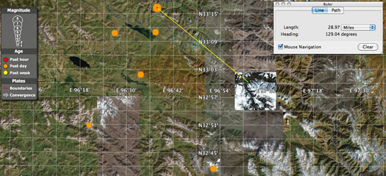
Maps of areas effectedGoogleEarth map 1 shows the initial quake and several aftershocks that occurred throughout the day, Wednesday. The first quake occurred at 5:40 am, followed by a 6.9 quake two hours later approximately 29 miles northwest of Yushu Town.
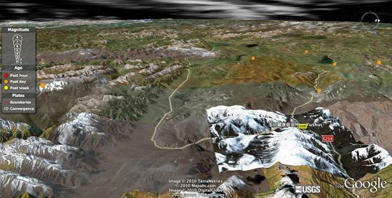
GoogleEarth map 2 shows a westward view from Yushu Town to the seven earthquake sites. Times, depths, and magnitudes of each event are available from the U.S. Geological Survey at http://earthquake.usgs.gov/earthquakes/catalogs/


no comments leave your own, follow the feed, or trackback